Property Record
1030 Route 202, East Amwell, NJ 08551
NEARBY LISTINGS FOR SALE OR LEASE
-
-
-
No Photo
-
View all East Amwell listings for sale on LoopNet.com
Property Detail
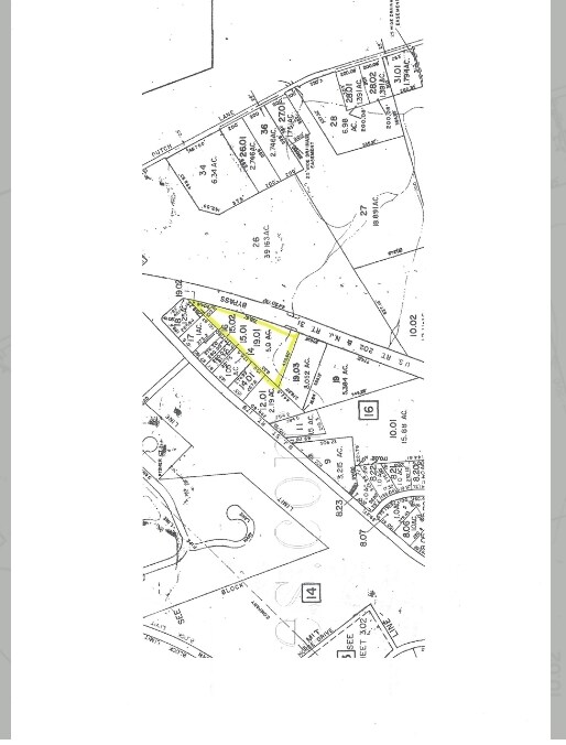
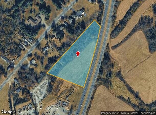
1030 Route 202
08-00016-0000-00019-01-Q0372
Hunterdon
Farms
New Jersey
X
19.1
34019C0361F
5 AC
2024
Hunterdon
2025
Northern New Jersey
011305
Newark, NJ-PA
DEMOGRAPHICS near 1030 Route 202
1 Mile
3 Mile
5 Mile
2024 Total Population
1,065
5,255
24,328
2029 Population
1,069
5,289
24,512
Pop Growth 2024-2029
+ 0.38%
+ 0.65%
+ 0.76%
Average Age
45
45
44
2024 Total Households
391
1,893
9,386
HH Growth 2024-2029
+ 0.26%
+ 0.58%
+ 0.78%
Median Household Inc
$119,999
$139,276
$120,373
Avg Household Size
2.70
2.70
2.60
2024 Avg HH Vehicles
2.00
2.00
2.00
Median Home Value
$497,825
$603,703
$470,833
Median Year Built
1975
1979
1982
Nearby Places
Map Layers
Map Styles
 Street
 Aerial
- Restaurants
- Banks
- Shops
- Fitness
- Groceries
PUBLIC TRANSPORTATION
AIRPORT
Trenton Mercer
DRIVE
WALK
Distance
Trenton Mercer
26 min
15.0 mi
Freight Ports
Port of Philadelphia
DRIVE
WALK
Distance
Port of Philadelphia
63 min
37.5 mi
SALE & LEASE HISTORY
LISTING DATE
SALE/LEASE

Mar 30, 2017
For Sale
Nearby Properties
Address
Land Use
TOTAL SIZE
Lot Size
Zoning
Address
Land Use
TOTAL SIZE
Lot Size
Zoning
Address
Land Use
TOTAL SIZE
Lot Size
Zoning
40 AC
AR-2
Address
Land Use
TOTAL SIZE
Lot Size
Zoning
Address
Land Use
TOTAL SIZE
Lot Size
Zoning
5.47 AC
B-2
Address
Land Use
TOTAL SIZE
Lot Size
Zoning
31.35 AC
VAL
Address
Land Use
TOTAL SIZE
Lot Size
Zoning
300.85 AC
VAL
Address
Land Use
TOTAL SIZE
Lot Size
Zoning
Address
Land Use
TOTAL SIZE
Lot Size
Zoning
10.26 AC
B-2
Address
Land Use
TOTAL SIZE
Lot Size
Zoning
1,516 SF
5.09 AC
B-2
Address
Land Use
TOTAL SIZE
Lot Size
Zoning
1,560 SF
136.68 AC
AR-2
Address
Land Use
TOTAL SIZE
Lot Size
Zoning
11 AC
VAL
Address
Land Use
TOTAL SIZE
Lot Size
Zoning
77.26 AC
AR-5
Address
Land Use
TOTAL SIZE
Lot Size
Zoning
148.35 AC
AR-5
Address
Land Use
TOTAL SIZE
Lot Size
Zoning
Address
Land Use
TOTAL SIZE
Lot Size
Zoning
72.39 AC
AR-2
Address
Land Use
TOTAL SIZE
Lot Size
Zoning
3.25 AC
B-5
Address
Land Use
TOTAL SIZE
Lot Size
Zoning
3 AC
LHC
Address
Land Use
TOTAL SIZE
Lot Size
Zoning
10,084 SF
2 AC
VAL
Address
Land Use
TOTAL SIZE
Lot Size
Zoning
10 AC
HO
Address
Land Use
TOTAL SIZE
Lot Size
Zoning
1,088 SF
3.59 AC
B-5
Address
Land Use
TOTAL SIZE
Lot Size
Zoning
89.44 AC
VAL
Address
Land Use
TOTAL SIZE
Lot Size
Zoning
5,236 SF
3.89 AC
LHC
Address
Land Use
TOTAL SIZE
Lot Size
Zoning
11,594 SF
1 AC
VAL
Address
Land Use
TOTAL SIZE
Lot Size
Zoning
3.90 AC
B-2
Address
Land Use
TOTAL SIZE
Lot Size
Zoning
16,800 SF
1.60 AC
LB
Address
Land Use
TOTAL SIZE
Lot Size
Zoning
6,329 SF
7.70 AC
HO
Address
Land Use
TOTAL SIZE
Lot Size
Zoning
8,915 SF
1 AC
VAL
Address
Land Use
TOTAL SIZE
Lot Size
Zoning
4.50 AC
B-5
Address
Land Use
TOTAL SIZE
Lot Size
Zoning
1.69 AC
B-5
Address
Land Use
TOTAL SIZE
Lot Size
Zoning
5,321 SF
2 AC
SRPD
The World's #1 Commercial Real Estate Marketplace
Connect with us
© 2025 CoStar Group
The information above has been obtained from sources believed reliable. While we do not doubt its accuracy we have not verified it and make no guarantee, warranty or representation about it. It is your responsibility to independently confirm its accuracy and completeness. Any projections, opinions, assumptions, or estimates used are for example only and do not represent the current or future performance of the property. The value of this transaction to you depends on tax and other factors which should be evaluated by your tax, financial, and legal advisors. You and your advisors should conduct a careful, independent investigation of the property to determine to your satisfaction the suitability of the property for your needs.